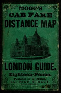
Mogg's Cab Fare Distance Map and London Guide. by Edward S. Mogg
"Mogg's Cab Fare Distance Map and London Guide" by Edward S. Mogg is a practical guidebook written in the mid-19th century. The book serves as an extensive reference for navigating London, featuring detailed fare information, a distance map, and an index of three thousand locations throughout the city. It is likely aimed at both locals and visitors, helping them to easily find their way around the bustling metropolis and understand the cab
fare system. The opening portion of the guide introduces the structure of the book, emphasizing its usability through an index that corresponds places with a grid system on the accompanying map. It explains the method for locating streets, squares, and cab stands, making it easier for readers to navigate the streets of London efficiently. The first few pages contain various entries that are systematically organized, illustrating the comprehensive nature of the guide and indicating its focus on practical navigation rather than storytelling or character development. (This is an automatically generated summary.)
Read or download for free
| How to read | Url | Size | |||
|---|---|---|---|---|---|
| Read now! | https://www.gutenberg.org/ebooks/55576.html.images | 262 kB | |||
| EPUB3 (E-readers incl. Send-to-Kindle) | https://www.gutenberg.org/ebooks/55576.epub3.images | 4.0 MB | |||
| EPUB (older E-readers) | https://www.gutenberg.org/ebooks/55576.epub.images | 4.0 MB | |||
| EPUB (no images, older E-readers) | https://www.gutenberg.org/ebooks/55576.epub.noimages | 95 kB | |||
| Kindle | https://www.gutenberg.org/ebooks/55576.kf8.images | 3.9 MB | |||
| older Kindles | https://www.gutenberg.org/ebooks/55576.kindle.images | 3.9 MB | |||
| Plain Text UTF-8 | https://www.gutenberg.org/ebooks/55576.txt.utf-8 | 98 kB | |||
| Download HTML (zip) | https://www.gutenberg.org/cache/epub/55576/pg55576-h.zip | 7.3 MB | |||
| There may be more files related to this item. | |||||
Similar Books
About this eBook
| Author | Mogg, Edward S. |
|---|---|
| Title |
Mogg's Cab Fare Distance Map and London Guide. Index to the Streets, Squares, and Cab Stands. |
| Credits |
Produced by Chris Curnow, Chuck Greif and the Online Distributed Proofreading Team at http://www.pgdp.net (This file was produced from images generously made available by The Internet Archive) |
| Reading Level | Reading ease score: 83.9 (6th grade). Easy to read. |
| Language | English |
| LoC Class | DA: History: General and Eastern Hemisphere: Great Britain, Ireland, Central Europe |
| Subject | London (England) -- Description and travel |
| Subject | London (England) -- Maps |
| Category | Text |
| EBook-No. | 55576 |
| Release Date | Sep 18, 2017 |
| Most Recently Updated | Jan 24, 2021 |
| Copyright Status | Public domain in the USA. |
| Downloads | 253 downloads in the last 30 days. |
| Project Gutenberg eBooks are always free! | |

